The short version
A building permit covers restumping. A planning permit only comes into it when an overlay in the Mornington Peninsula Planning Scheme says so, and the Shire's Planning Services on 03 5950 1010 is where the question goes. For many houses no overlay applies. For a house in one of the Sorrento or Portsea heritage precincts, on a sloping block at McCrae, Mount Martha or Mount Eliza, in a bushfire area or in the Green Wedge, something extra may, and the building surveyor asks before issuing the permit. This page says what the overlays are, where they are, and the position this site takes on each.
Heritage
The Shire's Heritage Overlay page says a planning permit is needed to construct a building, to pull one down, or to externally alter it by structural work or in any other way, and for works, repairs or maintenance that change the appearance of the building or are not undertaken to the same details, specifications and materials. Restumping is not mentioned. The position this site takes: like-for-like restumping that does not change the external appearance or the floor level is arguably maintenance; any visible change, a higher floor, a new base cladding, a different stump line showing below the weatherboards, can trigger a permit. Never assume either way. The Shire offers free heritage pre-application advice at heritage@mornpen.vic.gov.au, so ask the Shire's heritage team before you start.
Where the heritage places are:
- Sorrento and Portsea. The Sorrento Historic Precinct HO1 in four parts (HO1A commercial, HO1B foreshore, HO1C clifftop, HO1D residential), the East Sorrento Precinct HO488, and the Back Beach Road Portsea Precinct HO470, whose citation describes houses from the 1870s to the 1950s, limestone villas, timber cottages and bungalows, with fibro-cement in the inter-war bungalows. Amendment C262morn added 65 places and six precincts across Blairgowrie, Sorrento and Portsea, approved in November 2021 and May 2022.
- Area 1: Mornington, Mount Eliza and Mount Martha. The first municipal heritage review area, gazetted in March 2015.
- Area 2: Safety Beach to St Andrews Beach, including Rosebud, Rye, Tootgarook, McCrae and Capel Sound, gazetted 24 October 2019.
- Area 4: the Western Port side. Amendment C302morn proposes 58 new heritage places plus 15 others across Balnarring, Bittern, Crib Point, Flinders, Hastings, Main Ridge, Red Hill, Shoreham, Somers, Somerville and Tyabb. Exhibition runs from 29 October to 11 December 2026 and there are no interim controls, so nothing applies yet to those houses beyond what is already in the scheme.
- Victorian Heritage Register places such as the Continental Hotel in Sorrento (H1896, 1875), Beleura in Mornington (H0319, 1863) and Coolart at Somers need Heritage Victoria's approval separately from the Shire.
Erosion and landslip
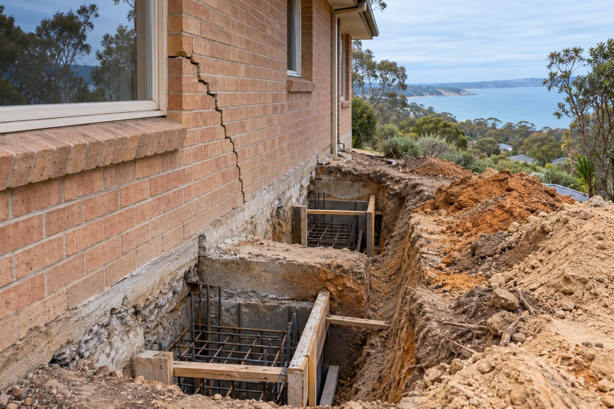
The Peninsula has had its ground move in recent years. On 29 September 2020 about 30 tonnes came down onto The Esplanade at Mount Martha and two access roads have been closed since, with retaining wall works running from November 2025 to December 2026. In November 2022 Mount Martha North beach was closed near the beach boxes after a cliff was assessed as unsafe. On 14 January 2025 a landslide at McCrae brought down a house on Penny Lane, and the Board of Inquiry delivered its final report on 9 September 2025.
The planning scheme's Erosion Management Overlay already covered the obvious ground: EMO1 and EMO2 in the hinterland from Arthurs Seat to Cape Schanck and Flinders; EMO3 at Ballar Creek in Mount Eliza; EMO4 and EMO5 at Tanti Creek in Mornington and the Flinders township; EMO6 along the Western Port coast from Somerville to Cape Schanck. After the Board of Inquiry the Minister approved EMO7, an interim shire-wide landslide overlay, in January 2026. It covered about 33,000 properties. Amendment C314morn, approved on 19 October 2026, cut that to about 6,000, added exemptions and a tiered pathway, and set field inspection areas at McCrae, Red Hill, Rye, Blairgowrie, Mount Eliza, Mount Martha and Portsea.
What an EMO does to a restump: building, earthworks and vegetation removal in an EMO area may need a planning permit and a landslide risk assessment by a qualified engineer or geologist. The Shire waives its fees where EMO7 is the sole trigger and no risk is apparent. The position this site takes: underpinning and restumping on a sloping block in an EMO area is where the engineer and the planner both get involved, and the first call is to ask the Shire whether your lot is still in EMO7 after C314morn. A flat block on the Rosebud sand is a different conversation from a cut-and-fill platform above the bay at McCrae, even though both may once have sat inside the same interim overlay.
What a landslide risk assessment looks like in practice: a qualified engineer or geologist visits the block, looks at the slope, the cut, the fill, the drainage and the vegetation, and writes up whether the proposed work changes the risk. For a like-for-like restump on a gentle slope that is often a short report. For underpinning below a cracked footing on a steep block above the bay, it can shape the design, because the engineer who assesses the slope is usually the engineer who designs the footings, and the two questions are the same question. The restumper works to that design, and the surveyor will not issue the permit without it.
| Overlay | Where | What it can mean for a restump or underpinning |
|---|---|---|
| Heritage Overlay (HO) | Sorrento HO1 and HO488, Portsea HO470, Area 1 and Area 2 review places, C262morn places | Like-for-like below the floor is arguably maintenance; any visible change can need a planning permit. Ask heritage@mornpen.vic.gov.au first. |
| EMO1 to EMO6 | Hinterland, Ballar Creek, Tanti Creek, Flinders, Western Port coast | Planning permit and a landslide risk assessment may be needed for building and earthworks. Engineer before restumper on a slope. |
| EMO7 (interim, narrowed by C314morn) | About 6,000 properties; field inspection areas at McCrae, Red Hill, Rye, Blairgowrie, Mount Eliza, Mount Martha, Portsea | Ask the Shire whether the lot is still in it. Fees waived where EMO7 is the sole trigger and no risk is apparent. |
| Bushfire Management Overlay and Bushfire Prone Area | Mapped by the state; much of the hinterland and bush edges | BMO needs a planning permit for certain development. In a BPA, alterations and additions must meet AS 3959 and the BAL is assessed at building permit stage. A restump alone rarely changes the rating; the surveyor says whether anything touches the subfloor. |
| Green Wedge | About 70 per cent of the Shire | A zoning matter rather than a subfloor one, but it shapes what else can be done to a house and whether a relocated dwelling is allowed. |
| Flood prone designation | A large percentage of the Shire | Not a planning overlay but a building one: report and consent under regulations 153 and 154. See the permits page. |
Bushfire
The Shire's bushfire page separates the two layers. The Bushfire Management Overlay in the planning scheme needs a planning permit for certain development. Separately, in a Bushfire Prone Area under the Building Act, new homes and alterations and additions must meet AS 3959 and the Bushfire Attack Level is assessed at building permit stage. A restump does not change a house's bushfire rating, but a building permit in a Bushfire Prone Area carries construction requirements and the surveyor says whether any apply to the subfloor, for instance enclosing it or screening the vents. The Green Wedge covers about 70 per cent of the Shire, which is why so many Peninsula houses sit at the edge of bush and paddock rather than in a suburb.
Heritage in practice
A worked example, because the heritage question is the one owners most often get wrong in both directions. A timber cottage in the Sorrento residential precinct HO1D has rotted stumps and a hallway that slopes. The owner wants the floor level again. Replacing the stumps like for like, at the same height, with the same weatherboards going back over the same base line, is arguably maintenance and the heritage team may say so in an email. Raising the house 300 mm to get clearance underneath, cladding the gap with new boards, or swapping a timber base line for a rendered one changes the appearance and is the kind of thing the overlay exists to catch. The difference is not the stumps, it is what the street sees afterwards. Asking first costs nothing; the Shire's heritage advice is free. Doing it the other way round can mean a retrospective planning application on top of the building permit, and a surveyor who will not issue the final certificate until the planner is satisfied.
How to check an address
- The state planning map. Zones and overlays for any lot, with HO, EMO and BMO each shown as a layer.
- The Shire's property information certificate. Regulation 51(2), $53.62 in 2025-26, stating whether the lot is flood prone and in the termite designation.
- Planning Services. 03 5950 1010 or planning@mornpen.vic.gov.au for whether a planning permit is needed, and heritage@mornpen.vic.gov.au for free pre-application advice on a heritage place.
- The surveyor. The registered building surveyor checks all of it before issuing the building permit, and lodges report and consent where it is needed.
What an overlay check cannot do
It cannot tell you whether the stumps under a heritage house have rotted; the overlay is about the street, not the subfloor. It cannot tell you whether a slope is going to move; the EMO says where the risk is mapped, and a landslide risk assessment says what it is for your block. It cannot tell you whether a lot is still inside EMO7 after Amendment C314morn; the Shire can. It cannot replace an engineer on a steep block, or Heritage Victoria on a registered place. And it cannot be skipped because the work is under the floor: the surveyor asks the overlay question on every permit, and the planner answers it.
Check the current rules before you rely on this
This page summarises the Mornington Peninsula Planning Scheme overlays most likely to touch a restumping or underpinning job and the position this site takes on each. It describes the rules in general terms as they stood in October 2026. Standards, forms, thresholds and fines change.
The authoritative sources are Mornington Peninsula Shire, Heritage Overlay and planning permits, Mornington Peninsula Shire, Amendment C262morn heritage review (Blairgowrie, Sorrento, Portsea), Mornington Peninsula Shire, municipal heritage review, Mornington Peninsula Shire, Amendment C302morn heritage review Area 4, Mornington Peninsula Shire, landslide susceptibility and the Erosion Management Overlay, Mornington Peninsula Shire, Minister approves interim Erosion Management Overlay across the Shire, Mornington Peninsula Shire, building in a bushfire prone area and Mornington Peninsula Shire, Distinctive Areas and Landscapes. Where anything here differs from those sources, they are right and we are not.
We are not building surveyors, engineers, planners or lawyers. For what applies to your house, ask a registered building surveyor or ring Mornington Peninsula Shire on 1300 850 600.
Accurate at the time of writing, October 2026. Always check the source before relying on it.